STRADA REGIA
Lake Como

The Strada Regia is an ancient route of about 35 km (22 miles) that connects Como to the southern border of Bellagio, passing through towns on the right bank of the western branch of Lake Como (including Brunate, Torno and Nesso).

The route alternates between old mule tracks, forest paths and carriage road routes, and allows you to enjoy splendid views of Lake Como and discover small gems of the area far from the tourist clamor.

❗ The hike on the Strada Regia does not have any particular difficulties with the exception of a few stretches, particularly the steep ascent to the Monti di Careno in leg #3. It is easily walked at any time of year, avoiding the hottest days in summer and snow in winter.

The Strada Regia can be divided into several stages, and since it often crosses villages located directly on the lake, if you only have a few hours to spare, you can travel even a single stretch and then return to the starting point via bus or boat 😀

Can’t wait to start your walk?? Learn all about the Strada Regia on Lake Como!

Useful tips

🎒 Things to bring with you
  • Power bank
  • A cape or poncho to cover yourself in case of rain, a hat for the sun
  • Comfortable hiking shoes
  • Energy snacks such as dried fruit and nuts. Some routes require you to bring a packed lunch
  • Water (at least 1 liter)
  • Sunscreen, cream for possible muscle inflammation, patches
  • The Komoot app!
🚨 In case of emergency

Call 112 for any kind of emergency

Things to bring with you
  • Power bank
  • A cape or poncho to cover yourself in case of rain, a hat for the sun
  • Comfortable hiking shoes
  • Energy snacks such as dried fruit and nuts. Some routes require you to bring a packed lunch
  • Water (at least 1 liter)
  • Sunscreen, cream for possible muscle inflammation, patches
  • The Komoot app!
In case of emergency

Strada Regia in 5 stages

For each section I have created a detailed description and a GPS map to follow on the Komoot app so you never get lost along the way!
Follow me on Komoot
and don’t miss any of my routes around Lake Como!

Strada Regia in 5 stages

For each section I have created a detailed description and a GPS map to follow on the Komoot app so you never get lost along the way! Follow me on Komoot and don’t miss any of my routes around Lake Como!

Strada Regia in 5 stages

1. Strada Regia | From Brunate to Torno

The first section is an easy route that can be done even in a morning. It starts from Brunate (which you can reach by the funicular from Como), goes through simple forest trails and mountain hamlets in the municipality of Blevio and then ends in Torno. From here you can proceed with the second section or return via bus or boat.

✨ Highlights

1. Como-Brunate funicolar.

2. The upper hamlets of Blevio: Capovico, Sopravilla, Sorto and Meggianico.

3. The village of Torno with its charming little square where you can take a café or have lunch with lake view.

📍 Facilities
Bars and restaurants

At the ends of this stretch are numerous bars and restaurants, both at the Como and Brunate funicular stations and in the village of Torno.

Pharmacies
Grocery stores
🥾 Trail description

From Como you can get to Brunate by funicular (watch out for queues in high season, which can last up to half an hour). Leaving the station, walk along Via Roma and after a short distance turn left into Via Nidirino. The paved road ends near the Nidirino sports center, and there, at the end of the soccer field on the right, the mule track to Capovico (hamlet of Blevio) begins.

The path descends narrowly into the woods and, after crossing two valleys, reaches a beautiful viewpoint over Cernobbio and Lake Como. At the next fork turn left, go around a group of farmsteads and continue to descend steeply toward Capovico.

Once in Capovico, turn right for the hamlet of Sopravilla and walk through the ancient alleys where it seems as if time has stood still. From Sopravilla enter Sorto and, past the Church of the Immaculata, cross the mule track that leads to Mezzovico.

Then, the trail goes through Meggianico and the steps leading to Cazzanore. Descend toward the lake after a short stretch of Strada Provinciale 583 (watch out for cars) and, before the tunnel, turn left toward the hamlet of Perlasca. At this point you will enter the municipality of Torno.

Arriving in Perlasca, go up via Rasina, and at the top of the cliff is the small Cappella del Tuè where there is a beautiful viewpoint over Torno, Moltrasio and the first basin of Lake Como, and immediately after the chapel the descent to the town center of Torno begins.

Here you will find the Church of San Giovanni where the Sacro Chiodo, one of the nails of the Passion of Christ, is preserved, and the Church of Santa Tecla where there are magnificent frescoes by Bartolomeo De Benzi.

You can also have coffee or lunch with a beautiful lake view in Piazza Giovio, the small square of Torno with its charming little harbor and public boat dock.

From Torno you can return to Como by ASF bus C30 (Como - Bellagio line) or by Navigazione Laghi boats.

2. Strada Regia | From Torno to Pognana

The stretch from Torno to Pognana offers beautiful naturalistic views (such as the Valle di Travaina in the upper part of Torno) and passes through some charming historic villages, such as Molina and Palanzo (both hamlets of Faggeto Lario), where time seems to stand still. From Pognana you can proceed with the third section or return via bus or boat.

✨ Highlights

1. Valle di Travaina, crossed by the Stravalle stream over which stands a beautiful stone bridge. Also in the valley is a remnant of a stone city gate (Porta di Travaina) that, in addition to being part of the ancient circuit surrounding the village, functioned as a duty collection point.

2. The upper hamlets of Faggeto Lario: Molina, Brema, Lemna and Palanzo. With a small detour you can also reach the famous Palanzo wine press, built in 1572 and used for pressing grapes and obtaining walnut oil.

3. Church of San Rocco and Church of Santissima Trinità in Pognana Lario.

📍 Facilities
Bars and restaurants

Bars and restaurants are mainly concentrated in Torno. Several bars and trattorias are also found in the hamlets of Molina and Palanzo. Finally, a couple of bars can be found in the historic center of Pognana. Note: do not always rely on the hours found on Google, as it is possible that especially in the off-season businesses may close earlier than expected.

Pharmacies
Grocery stores
🥾 Trail description

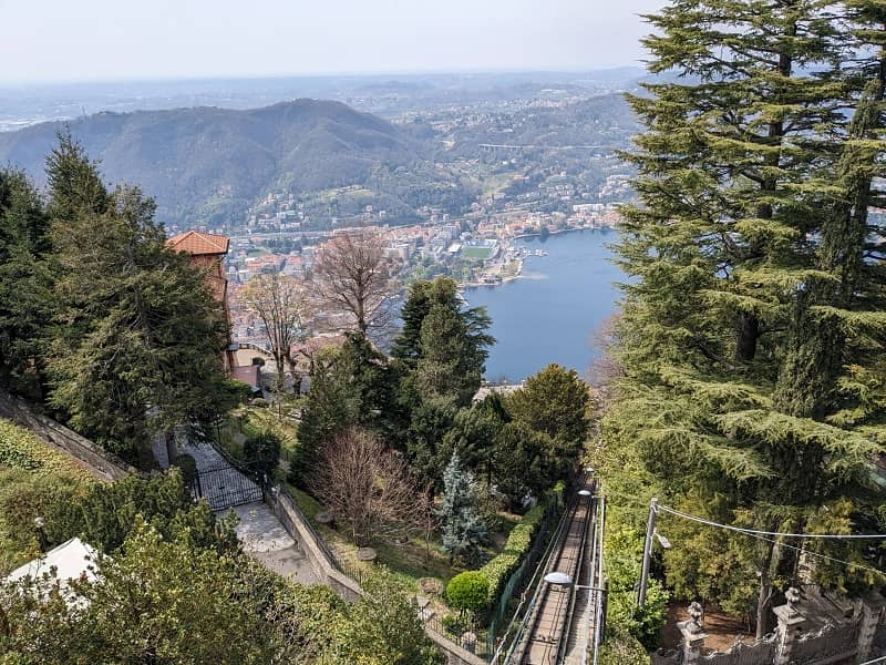
From Torno, head toward Via Pozzo where the Strada Regia sign is located. At the next fork, the route would then continue along Via per Molina, but I preferred to take the steeper Via per Piazzaga that leads to Valle di Travaina.

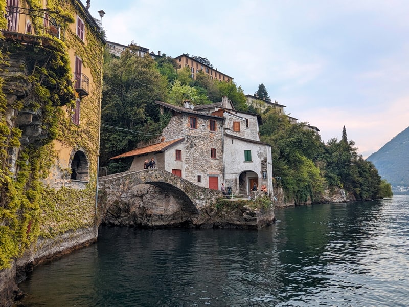
Through a forest path, this detour leads to a lovely valley, crossed by the Stravalle stream, which is reached by passing the remains of the Porta di Travaina, an ancient stone town gate that formed part of the entrance to the ancient village. A chapel and the stone bridge over the stream contribute to making this place unique to me.

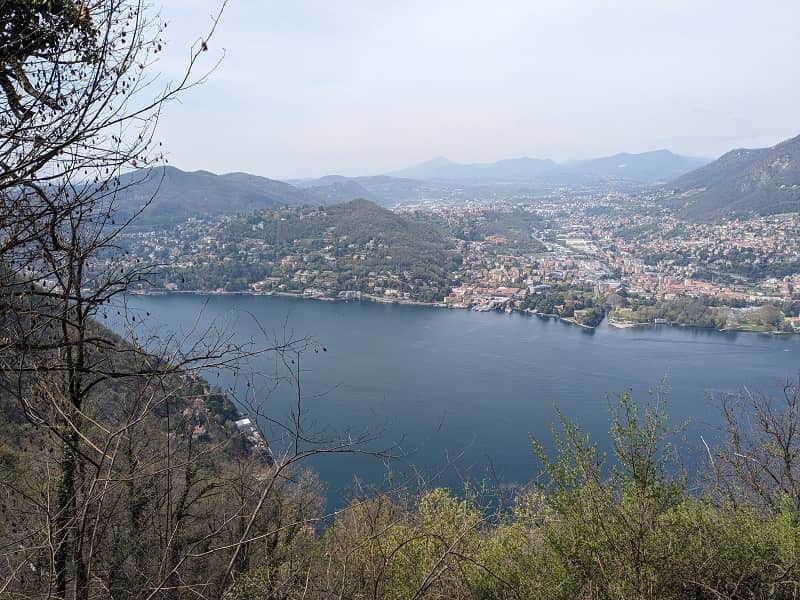
In any case, both Via per Molina and the detour lead to Strada Provinciale 583. After a short stretch of carriage road, take the path to the right that climbs into the woods.

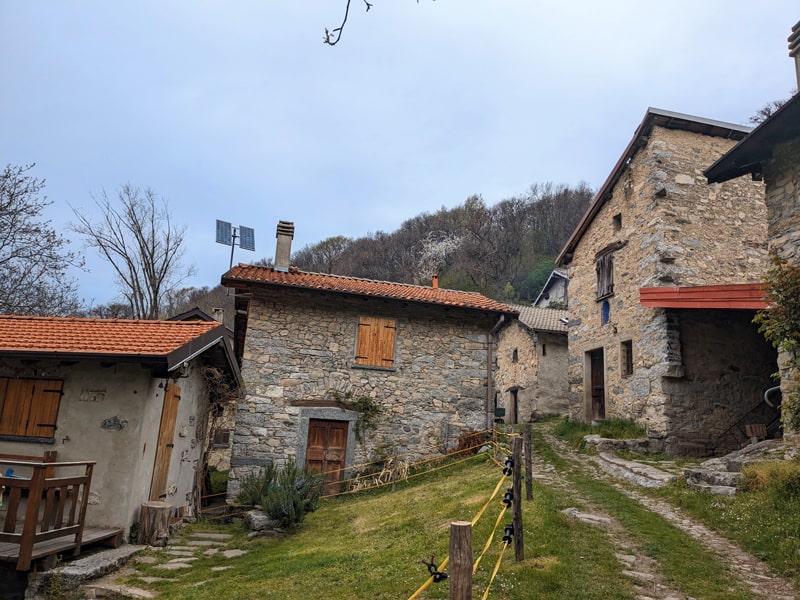
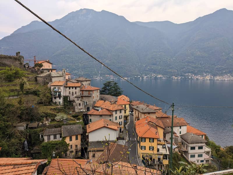
When you reach the ancient bridge over the Valle Pliniana, you enter the territory of Faggeto Lario. From the Chapel of San Rocco, climb toward Molina, a hamlet of Faggeto Lario and a small jewel in the hills of the Larian Triangle. Here you can have lunch at an osteria in the village square, but remember to check opening hours in advance if you plan to eat here.

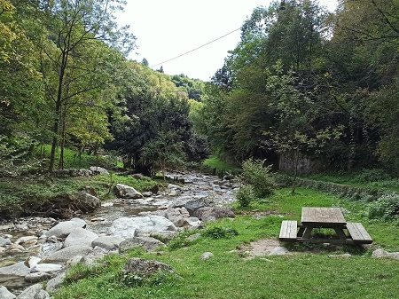
The route leaves the hamlet along Via Fontana Vecchia, crosses the Valle dei Molini, and continues through the meadows of Brema, from which you can see the hamlet of Lemna. It then crosses the valley stream and, after crossing some cultivated terraces, meets the Chapel of Madonna del Rosario, which anticipates the entrance to the hamlet of Lemna.

After crossing the village to the Church of San Giorgio, the route continues on the paved road (via Bernardo Silo) and then on the provincial road until it reaches Palanzo.

A detour to the right takes you into the heart of the ancient village where you can visit the Church of Sant'Ambrogio and the famous Torchio, a big wine press made in 1572.

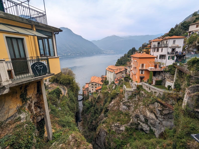
Leaving the village along Via Pisciola, descend toward Pognana Lario passing through a beautiful forest path. You will arrive at the Church of San Rocco thus entering the hamlet of Canzaga, and then reach the Church of Santissima Trinità located at the edge of the historic center of Pognana.

From here it is possible to reach Strada Provinciale 583 via the center of Pognana and return to the starting point by bus C30 (Como - Bellagio line) or by Navigazione Laghi boats.

3. Strada Regia | From Pognana to Nesso

This section is the wildest, as it takes place mostly on a forest path. Coming out of Pognana you face a particularly steep climb that leads to some old huts, so it is better to be a little bit trained. When you reach Nesso, with a view of its beautiful Orrido, you can proceed with the fourth section or return via bus or boat.

✨ Highlights

1. The town of Pognana Lario and its hamlets (Rovasco, Quarzano).

2. Monti di Careno, a group of stone cottages (in the municipality of Nesso) used in the past during periods of cattle transhumance.

3. The town of Nesso and its Orrido, the gorge shaped over the centuries by the incessant flow of water, which can be admired from Piazza Castello.

📍 Facilities
Bars and restaurants

In addition to the few bars and restaurants in Pognana, you can find several places to have a meal in the village of Nesso, especially around Piazza Castello.

Pharmacies
Grocery stores
🥾 Trail description

Cross Pognana Lario along Via Quarzano to the Church of San Miro in Rovasco, outside of which you can admire 13th-century frescoes in the Byzantine tradition. Continue along Via Careno to Quarzano, hamlet of Pognana Lario, where you will find a fork in the road.

The road to the right, the one I took, takes a path up through the woods to the Monti di Careno, stone cottages used in the past during periods of cattle transhumance. You will feel like you are a thousand light years away from the Lake Como you probably had in mind!

If you look at the map, you will notice that this is a particularly steep trail, with gradient peaks even around 35 percent. If you want to make less of an effort, at the Quarzano junction you can continue left on Via Careno until you reach the carriage road; from here, reach Careno (hamlet of Nesso) and climb back up to the Strada Regia from the road that starts from Meriggio (it is still steep, but it lasts a little less).

Go down Via dei Monti until you cross the mule track to Nesso. Pass the ruins of the ancient castle (unfortunately not open to visitors) and arrive at Piazza Castello, where you will enjoy a splendid view of the Orrido. Find out here how to get to the Nesso gorge viewpoint!

Around Piazza Castello you can find several bars where you can have a meal and also the stop of the C30 bus that can take you to Como or to Bellagio. If you go deeper into the village of Nesso you will also find the public boat dock.

4. Strada Regia | From Nesso to Lezzeno

This section passes through the upper hamlets of Nesso (including charming Vico) and reaches, after a route offering beautiful views of Lake Como, the hamlet of Carvagnana in Lezzeno. From here it is possible to continue with the last section or descend to the village and return via bus.

✨ Highlights

1. The old hamlets of Nesso, such as Lissogno and Vico

2. Church of Santa Maria (in the hamlet of Vico)

3. The beautiful views of the lake during the trail from Nesso to Lezzeno.

📍 Facilities
Bars and restaurants

In addition to the bars and ice cream parlors that are mainly concentrated in the village of Nesso, the Baita La Morena farmhouse is also located on this route, nestled in the woods. The hamlet of Carvagnana in Lezzeno has no bars or restaurants.

Pharmacies
Grocery stores
🥾 Trail description

Also this section allows you to choose two route variants starting from Piazza Castello in Nesso.

The variant for the well-trained, the one you find in this map, starts from the stairway from Piazza Castello and continues through the hamlets of Lissogno and Vico. After a nice stretch in the woods, the trail crosses the mule track that climbs from Via Borgonuovo (the other road).

Choosing the low variant, from Piazza Castello descend toward the lake until you reach the Ponte della Civera, from which there is a breathtaking view of the Nesso gorge. Then, walk along Via Coatesa and Via Borgovecchio to the Church of Santi Pietro e Paolo. Carefully transit Strada Provinciale 583 and, having reached a small chapel, turn right onto the path that climbs into the woods until you reach the high variant.

After passing a long, slightly uphill stretch, you will overlook Punta della Cavagnola, where the western end of the Monte San Primo ridge enters the waters of the lake. You thus enter the territory of Lezzeno, more specifically the hamlet of Carvagnana.

From here, you can cross the hamlet to reach the Strada Provinciale and take the C30 bus to Como or to Bellagio.

5. Strada Regia | From Lezzeno to Bellagio

(coming soon)

Experiences & tours

Make your trip a unique experience!​

Como-Brunate-Torno
Como-Brunate-Torno: breathtaking scenery
Ponte del Diavolo, Lezzeno
Devil’s Bridge: hike between Lezzeno and Bellagio
Val Senagra
Val Senagra:
the enchanted valley
The tower of Castello Baradello, Como
Exclusive tour of a medieval castle over Como city
Related posts

Leave a Reply

This site is protected by reCAPTCHA and the Google Privacy Policy and Terms of Service apply.